cottleville trails
Transforming A Floodplain Into A Vibrant New Community
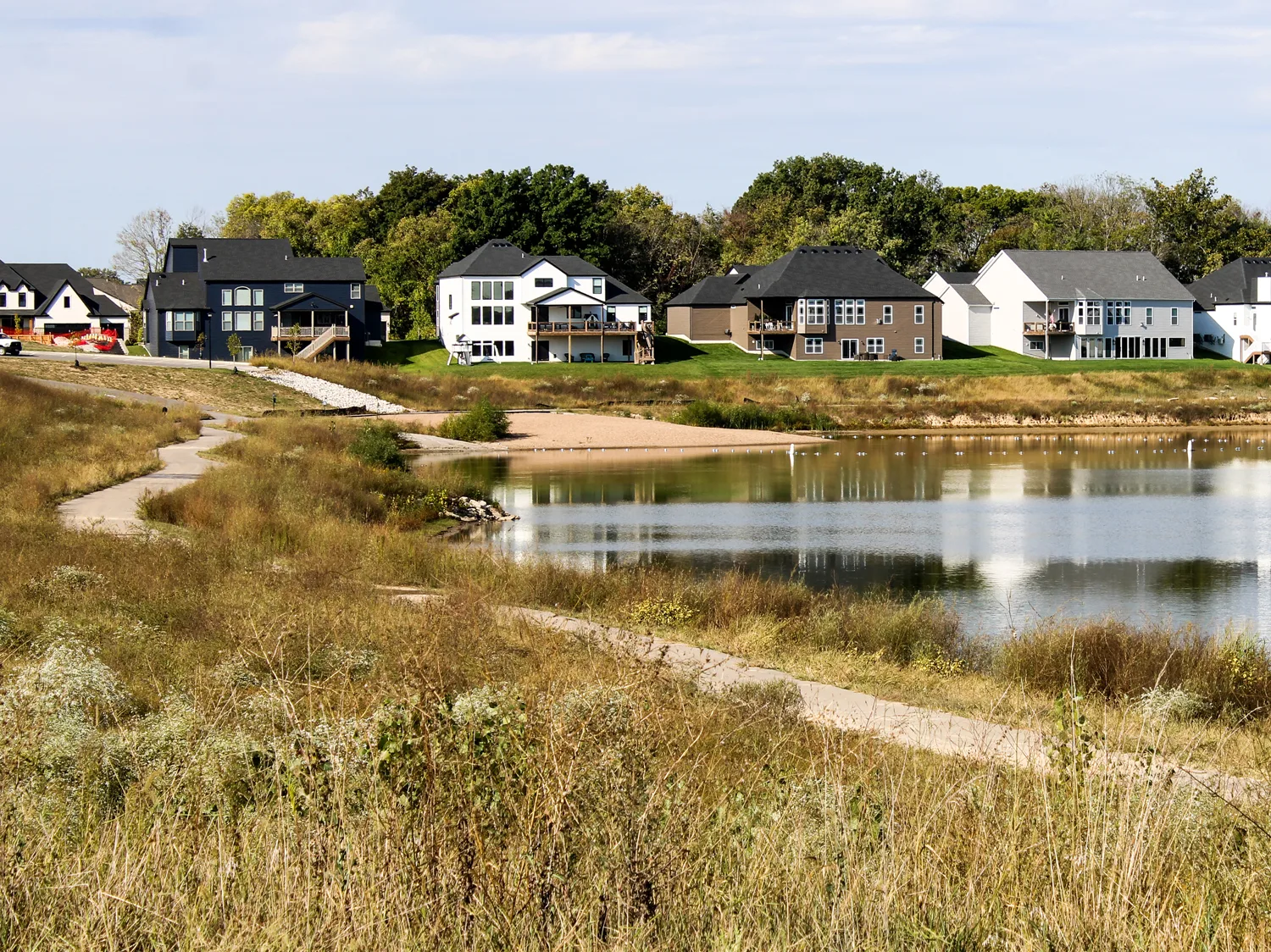
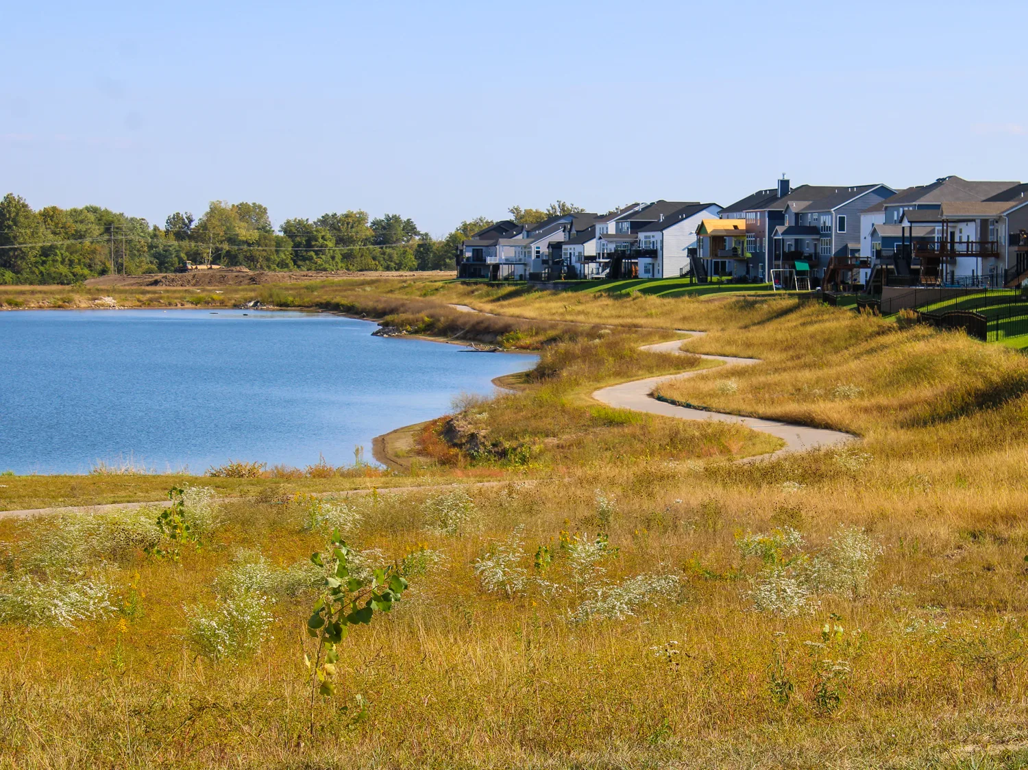
Spanning 337 acres in the heart of St. Charles County, Cottleville Trails stands as one of the largest and most defining residential developments in Bax Engineering’s portfolio. What began as a vision to create a connected community centered around lakes, walking paths, and open green space evolved into a coordinated effort involving thoughtful design, collaboration, and long-term planning.
Developed by DCM Land, LLC, the project required precise management of floodplain conditions, extensive grading, and coordination among multiple public agencies. Bax Engineering played a central role from concept through construction, providing a full range of in-house services including surveying, floodplain analysis, grading design, and stormwater management to make the development both buildable and sustainable.
the challenge
Located within an active floodplain, the Cottleville Trails site presented an immediate and complex engineering challenge: how to elevate and protect future homes without increasing flood risk elsewhere.
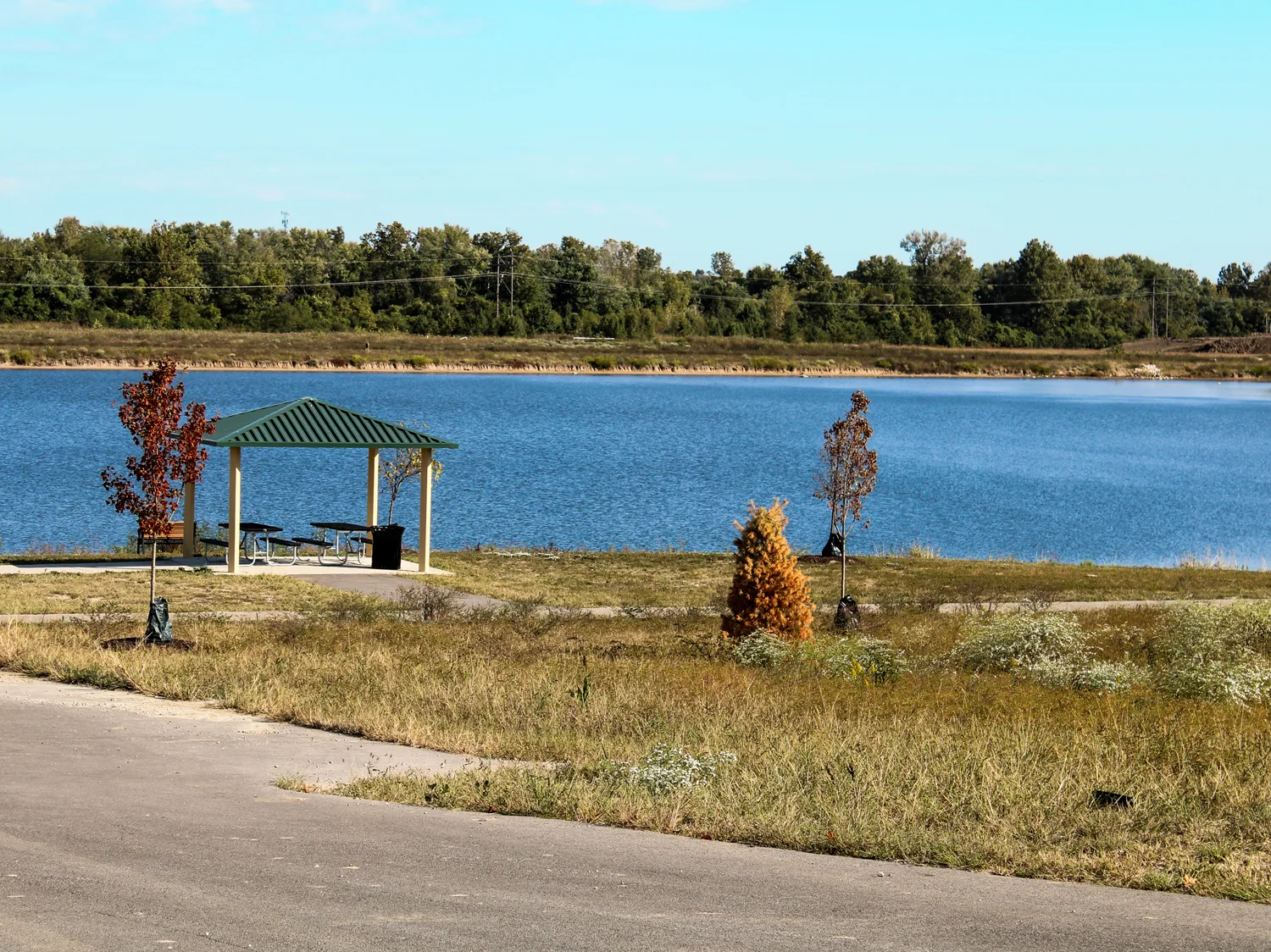
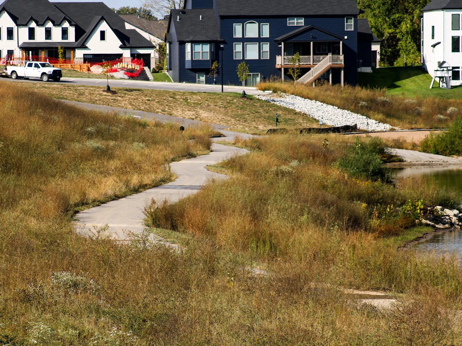
The project required moving more than 3 million cubic yards of earth, designing new lakes that both sourced fill material and created aesthetic and recreational amenities, and completing extensive floodplain and hydrology modeling to meet FEMA compliance standards.
Beyond the technical difficulty, the project also demanded close coordination between city officials, FEMA, multiple builders, and the development team. Each phase required meticulous analysis to ensure there was no rise in the base flood elevation, even as the property’s floodway was modified.
The development’s scale and zoning complexity added to the challenge. Initially approved for a mix of single-family, attached, and apartment homes along with community amenities, the plan was later refined to include single-family and townhome residences, walking trails, lakes, and shared recreational spaces – all within a planned development framework. Each zoning revision required new engineering coordination and FEMA review to maintain compliance as the design evolved.
“Cottleville Trails challenged us to think differently about floodplain development. Our in-house coordination across survey, engineering, and floodplain management made it possible to deliver a complex project efficiently and responsibly.”
the solution
Bax Engineering approached the project with a coordinated strategy that brought surveying, engineering, and regulatory design together under one plan. The team conducted detailed boundary and floodplain surveys to establish site limits and elevations, then developed grading and stormwater designs that turned the property’s natural challenges into opportunities. A system of interconnected lakes provided both the necessary fill material and a lasting amenity for the community.
By managing floodplain studies, FEMA map revisions, and infrastructure design in-house, Bax ensured a consistent approach from start to finish. Collaboration among surveyors, engineers, and project managers kept approvals moving efficiently and maintained the project’s momentum through each phase.
the results
Cottleville Trails has redefined what’s possible in residential development within a floodplain. The design not only restored and enhanced the site’s hydraulic performance but also created a resilient, attractive neighborhood featuring trails, open space, and recreational lakes.
Homes have sold quickly, reflecting both the desirability of the location and the confidence that comes with sound engineering. The project continues to expand with additional phases, reinforcing its long-term success.
With all major components handled in-house, from surveying to construction documentation, Bax Engineering ensured a seamless process that few firms could match in both scope and precision.
the bax difference
Cottleville Trails demonstrates Bax Engineering’s capacity to manage large, multifaceted developments that demand coordination across multiple disciplines and regulatory layers.
Over 3 million cubic yards of earth moved to raise home sites above flood elevation, creation of multiple lakes for fill and community amenities, and FEMA map revisions to document floodplain changes.
project overview
CLIENT
DCM Land, LLC
LOCATION
City of Cottleville, St. Charles County, Missouri
PROJECT DATES
2018 – Ongoing, Multi-phase development
SITE SIZE
337 acres (approx)
services provided
Land surveying (boundary, topographic, ALTA/NSPS
Subdivision design & platting
Floodplain studies & mitigation plans
Site planning & grading design
Stormwater management & roadway design
Zoning & entitlement support
Construction stakeout, plot plans & as-builts
partners
City of Cottleville
FEMA (map review & approval)
Kolb Grading
DCM Land LLC
EXPLORE THIS PROJECT
Click on the photo to see full images